Stormwater Site Assessment: How We Read Water Clues
Water rarely moves across a property without leaving evidence behind. Eroded slopes, sediment deposits, exposed roots, discolored concrete, flattened vegetation, standing water, and deteriorating outfalls can all reveal how runoff behaves during and after a storm.
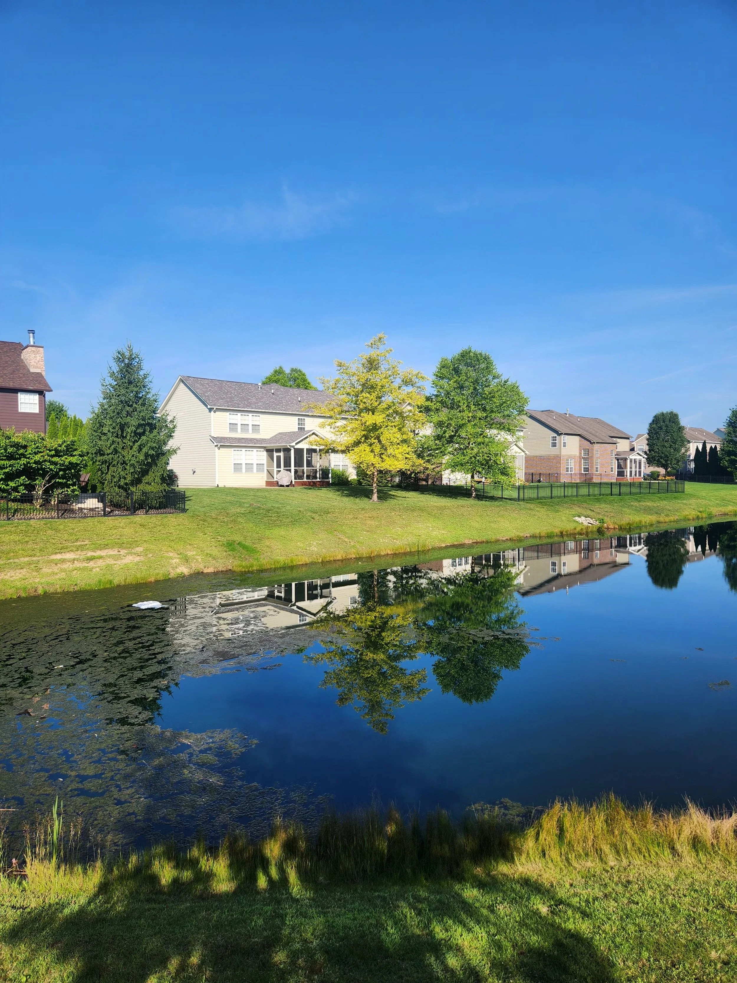
A stormwater site assessment is the process of interpreting those clues as parts of one connected system. Instead of examining an eroded bank, clogged pipe, or wet area in isolation, Ecological Improvements evaluates how water enters the property, where it concentrates, what materials it carries, how infrastructure influences its path, and where the resulting stress appears.
This system-based approach is important because the location of visible damage is not always the source of the problem. Sediment at an outfall may originate from an unstable slope farther upstream. Recurring bank erosion may reflect excessive runoff velocity rather than a lack of vegetation. Standing water may be caused by an obstructed outlet, altered grading, compacted soil, or insufficient conveyance capacity.
Reading a site correctly allows property owners and managers to move beyond repeated surface repairs. It creates a clearer basis for prioritizing maintenance, planning erosion control, improving drainage performance, and determining when additional engineering or regulatory review may be necessary.
What Water Can Reveal About a Property
Stormwater follows gravity, but its path is influenced by topography, soil conditions, vegetation, pavement, buildings, drainage structures, and previous site modifications. Every one of those elements affects how quickly water moves, where it collects, and whether it infiltrates, disperses, or becomes concentrated runoff.
A site assessment begins by observing these relationships. The goal is not simply to locate water. It is to understand the sequence of conditions that produces the visible outcome.
Erosion shows where hydraulic stress is occurring
Erosion is one of the clearest signs that the forces acting on soil exceed the site’s ability to resist them. Small rills across bare ground may indicate sheet flow beginning to concentrate. Deeper channels or gullies can point to recurring high-velocity runoff, concentrated discharge, or a failed drainage path.
The shape and location of erosion matter. Scour immediately below a pipe may suggest that the outlet lacks adequate energy dissipation. Erosion along the outside bend of a channel may result from concentrated velocity and repeated shear stress. An undercut bank may indicate fluctuating water levels, toe erosion, inadequate root reinforcement, or a combination of these conditions.
Exposed roots are another useful indicator. They can show that the soil surface has gradually lowered or that flow is repeatedly removing material from around established vegetation. While roots may temporarily help hold the remaining soil together, they do not necessarily mean the area is stable.
The USDA Natural Resources Conservation Service identifies rills, channels, soil deposited at the base of slopes, and sediment entering waterways as observable symptoms of water erosion. These features help establish where soil is being detached, transported, and deposited across a site. USDA Natural Resources Conservation Service
Sediment shows where water loses energy
When runoff slows, it loses some of its ability to carry soil particles. Sediment deposits therefore provide information about changing velocity, flow direction, storage capacity, and obstructions within the drainage system.
A fan-shaped deposit at the bottom of a slope may identify the point where concentrated flow spreads out. Sediment around a curb inlet can indicate that material is being transported from an upstream disturbed area. Deposits inside a swale, catch basin, pond, or pipe may reveal declining conveyance or treatment capacity.
The type of sediment also contributes information. Coarser material generally settles sooner than fine particles, while silts and clays can remain suspended and travel farther downstream. A sequence of deposits may help a trained observer reconstruct the direction and approximate behavior of previous runoff.
Sediment accumulation should not be treated only as a housekeeping issue. Removing deposits may restore some function, but recurring sediment means the system is receiving material from an active source. Effective sediment control therefore requires identifying both where material accumulates and where erosion begins.
Staining and debris reveal previous water elevations
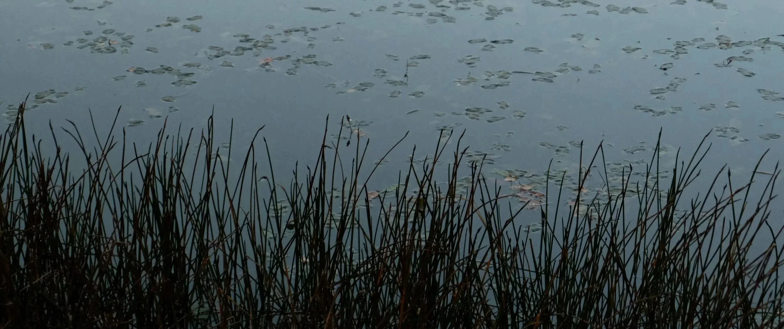
Water may no longer be present when an inspection occurs, but staining can indicate where it has been. Waterlines on concrete, retaining walls, pipes, risers, and other structures may show recurring ponding or high-water conditions.
Organic debris can provide similar evidence. Leaves, pine straw, trash, and branches caught against a fence or wrapped around vegetation may mark the approximate elevation and direction of stormwater flow. Flattened grass can show where runoff crossed an otherwise dry area.
Mineral deposits, rust staining, algae, and persistent soil discoloration may also help distinguish a frequently wet area from one affected by a single storm. These clues must be interpreted carefully because irrigation leaks, groundwater, utility problems, and other sources can produce similar conditions.
Vegetation reflects long-term moisture and disturbance
Vegetation often records site conditions over a longer period than a single inspection can capture. Bare soil may suggest erosion, excessive shade, compaction, foot traffic, unsuitable plant selection, or repeated inundation. Dense invasive growth may conceal failing infrastructure or limit maintenance access.
Healthy vegetation can reinforce soil and reduce the movement of sediment, but plant coverage alone does not confirm that a stormwater system is functioning properly. Some plants tolerate standing water and may thrive in an area where drainage has changed. Others may die back because the soil remains saturated longer than the original planting design anticipated.
This is why sustainable stormwater planting requires more than selecting plants that look appropriate. Soil moisture, water-level fluctuations, slope, sunlight, runoff velocity, rooting characteristics, and maintenance access all affect whether vegetation will contribute to long-term stability.
How a Stormwater Site Assessment Follows the Water
A useful stormwater site assessment does not begin and end at the most visibly damaged location. It follows the water through the property, starting with contributing drainage areas and continuing through collection, conveyance, treatment, discharge, and downstream receiving conditions.
This approach helps distinguish causes from symptoms. It also reduces the risk of recommending a repair that shifts the problem to another part of the system.
We identify where the runoff originates
The first step is understanding what contributes water to the affected area. Roofs, parking lots, roads, sidewalks, landscaped slopes, construction areas, neighboring properties, and natural drainage areas can all contribute runoff.
Impervious surfaces are especially important because they limit infiltration and can produce runoff more quickly than vegetated soil. A relatively small drainage feature may receive water from a much larger paved area, making the size of the contributing watershed more important than the dimensions of the visible channel or basin.
Land use also affects what the runoff carries. Parking areas may contribute sediment, litter, and vehicle-related pollutants. Landscaped areas may contribute mulch, soil, leaves, or fertilizer. Active construction areas can introduce large sediment loads when stabilization and perimeter controls are incomplete or poorly maintained.
A field assessment may compare visible drainage patterns with available plans, maps, or construction documents. Differences between the intended design and current site conditions can reveal grading changes, added impervious surface, disconnected drainage features, or unauthorized alterations that affect system performance.
We trace how water becomes concentrated
Runoff often becomes more erosive as separate flow paths combine. Water leaving a roof downspout may cross a small landscaped area before joining parking-lot runoff. Sheet flow may become concentrated along a curb, at a low point, or within an informal channel created by repeated storms.
The transition from dispersed flow to concentrated flow is a critical assessment point. Concentration increases depth and velocity, which can increase erosive force. If the receiving surface is not stabilized for those conditions, deterioration may progress quickly.
Drainage paths are not always obvious during dry weather. Subtle depressions, aligned sediment, matted vegetation, surface staining, and isolated scour can help connect individual sections of the flow path. Topographic changes and structural features can then be used to verify whether the interpretation is consistent with the site.
We evaluate conveyance and treatment components
Once runoff enters the formal stormwater system, the assessment examines the structures responsible for moving or treating it. These may include catch basins, inlets, pipes, swales, channels, culverts, detention ponds, retention areas, forebays, outlet control structures, and outfalls.
Each component is evaluated in relation to its intended function. An inlet must remain accessible to runoff. A pipe must convey flow without significant blockage or structural failure. A swale must maintain a stable cross-section and sufficient vegetation. A pond must preserve the storage, treatment, and outlet conditions required for performance.
Sediment, vegetation, debris, displaced stone, cracked concrete, joint separation, corrosion, and animal activity can all affect function. However, the presence of a defect does not automatically establish its significance. The assessment considers whether the defect is isolated, progressive, structurally important, or connected to other failures.
Maintenance history provides useful context. A structure that repeatedly clogs after cleaning may have an upstream source problem. A repaired slope that continues to erode may be receiving more concentrated flow than the repair was designed to manage. Recurrence is evidence that the underlying process has not been fully addressed.
We inspect the discharge and downstream response
The outfall is where the performance of the upstream system often becomes visible. Scour holes, displaced riprap, channel incision, bank instability, sediment plumes, exposed pipe ends, and failing headwalls can indicate excessive velocity, inadequate stabilization, structural deterioration, or changing downstream conditions.
An outfall cannot be evaluated only by looking at the end of the pipe. The assessment must also consider the receiving area. If downstream erosion is causing the channel bed to lower, the outfall may become undermined even when the original installation was appropriate.
Downstream observations also help determine whether a proposed repair could transfer risk. Increasing conveyance through one area may send water downstream more quickly. Stabilizing a single bank without addressing toe erosion or channel alignment may protect one location while increasing stress elsewhere.
A complete outfall assessment therefore connects upstream drainage, pipe condition, outlet protection, channel geometry, bank stability, vegetation, and downstream constraints. Property teams can learn more about these relationships in a dedicated guide to stormwater outfall maintenance and long-term system performance.
The Site Clues We Evaluate During an Inspection
Stormwater inspections are most useful when observations are organized around function rather than appearance. A property may look generally maintained while still containing early signs of hydraulic, structural, or environmental stress.
Ecological Improvements evaluates the site as a series of connected zones. The exact inspection scope depends on the property, known concerns, available documentation, and whether the purpose is routine maintenance, corrective planning, construction readiness, or regulatory support.
Surface drainage and grading
Surface grading determines where water is directed before it reaches a formal drainage structure. Depressions, berms, compacted soil, landscaping modifications, and pavement settlement can all redirect runoff from its intended path.
During an assessment, we look for standing water, unintended channels, drainage away from or toward structures, and low points that collect sediment or debris. We also evaluate whether water is bypassing inlets or crossing areas not designed to carry concentrated flow.
Minor grading changes can have system-wide effects. Added landscape beds, resurfaced pavement, new curbs, utility work, or accumulated sediment may alter drainage without appearing to be a major site modification.
Evidence of ponding is interpreted in context. Temporary storage may be part of the design, particularly in detention or bioretention systems. Persistent water in an area intended to drain, however, may indicate poor infiltration, compaction, obstruction, insufficient slope, groundwater influence, or outlet limitations.
Slopes, banks, channels, and shorelines
Slopes are evaluated for bare soil, rilling, slumping, cracking, exposed roots, displaced stabilization materials, and changes in vegetation. The position of each symptom can help identify whether instability begins at the top, face, toe, or adjacent drainage area.
A bank with vegetation may still be unstable if water is removing soil beneath the root zone. Similarly, adding plants to an actively eroding slope may not succeed if concentrated runoff, wave action, or toe scour remains uncontrolled.
Channels are assessed for incision, widening, sediment bars, debris accumulation, vegetation encroachment, and changes in alignment. These conditions can indicate that flow, sediment supply, and channel capacity are no longer balanced.
Pond and lake shorelines require additional attention to fluctuating water levels, wave exposure, bank angle, access patterns, and outlet conditions. Where appropriate, shoreline stabilization may incorporate vegetation, structural components, or living shoreline principles based on site-specific hydraulic and ecological conditions.
Inlets, pipes, culverts, and outfalls
Drainage structures are inspected for conditions that limit flow or threaten structural integrity. Common clues include obstructed openings, sediment accumulation, damaged grates, cracked walls, joint separation, corrosion, displaced sections, sinkholes, and erosion around the structure.
A sinkhole near a pipe is particularly important because it may indicate soil entering through a failed joint or damaged section. Surface filling alone may temporarily hide the opening without stopping the internal loss of material.
Pipe ends and headwalls are examined for undermining, separation, rotation, cracking, and loss of supporting soil. Outlet protection is evaluated for displacement, burial by sediment, inadequate extent, or evidence that flow is bypassing the stabilized area.
Access is also part of performance. A structure that cannot be safely reached may not receive timely inspection or maintenance. Vegetation management should therefore protect the site while preserving access to inlets, outlets, risers, control structures, and other critical components.
Vegetation, soil, and exposed surfaces
Vegetation is evaluated as functional infrastructure. Coverage, density, root characteristics, species suitability, invasive growth, mowing practices, and evidence of stress all affect how well planted areas protect soil and support stormwater performance.
Exposed soil is examined for crusting, compaction, rills, sediment movement, and evidence of recent disturbance. Soil texture and moisture conditions may influence which stabilization methods are likely to succeed.
Mulch and loose landscape material can also become part of the drainage problem. When placed in concentrated flow paths, these materials may wash into inlets, pipes, and ponds. Their movement can identify where runoff is stronger or more concentrated than anticipated.
Plant selection should respond to the actual site conditions revealed by the assessment. A low area with fluctuating water levels requires different vegetation than a dry upper slope. A high-velocity conveyance area may require additional stabilization beyond plants alone.
Maintenance and operational evidence
A site’s maintenance practices leave clues just as water does. Freshly cleared inlets, recently replaced stone, patched erosion, and mowed access routes can show where recurring attention is already being directed.
The assessment considers whether that maintenance addresses the source or only the result. Replacing washed-out soil without controlling runoff is unlikely to provide a durable outcome. Repeatedly removing sediment without stabilizing its source may consume resources without improving the overall system.
Operational information from property staff can add important context. Reports about when flooding occurs, which structures clog first, how long water remains after storms, and which repairs have failed can help connect present field conditions with storm behavior that was not directly observed.
This information does not replace physical evidence, but it strengthens the interpretation. The most useful site assessment combines field observations, drainage logic, maintenance history, documentation, and site-specific constraints.
From Field Observations to a Practical Stormwater Management Plan
The purpose of reading a site is not to produce a longer list of defects. It is to convert physical evidence into an organized understanding of risk, maintenance needs, and corrective priorities.
A practical plan distinguishes urgent conditions from routine maintenance and long-term improvements. It also recognizes when more information is needed before a reliable solution can be selected.
We separate the symptom from the source
Visible erosion is a symptom. The source may be concentrated runoff, a failed pipe, unstable soil, excessive slope, inadequate outlet protection, or an upstream grading change.
Sediment accumulation is also a symptom. The source may be a bare construction area, an eroding bank, an unstable access road, failing shoreline soil, or material entering from outside the property.
Separating source and symptom prevents narrow repairs. If only the symptom is addressed, the same damage may return or appear elsewhere. When the source is identified, maintenance and capital improvements can be directed toward the process creating the problem.
This distinction is especially valuable when multiple issues overlap. For example, an eroded pond bank may receive concentrated surface runoff from above while also experiencing toe erosion from fluctuating water levels below. A successful stabilization plan must account for both forces.
We establish priorities based on function and risk
Not every observed condition requires the same response. Some items are routine maintenance needs, while others may indicate active structural deterioration, safety concerns, regulatory exposure, or a high probability of continued damage.
Priority is based on factors such as:
Whether the condition obstructs drainage or treatment
Whether erosion is active and progressing
Whether a structure may be losing support
Whether sediment can leave the site or enter a receiving water
Whether the problem affects access, safety, or adjacent property
Whether delaying action is likely to increase repair complexity
Whether the condition may affect permit, inspection, or maintenance obligations
A blocked inlet before a forecasted storm may require immediate maintenance. Minor vegetation thinning on a stable slope may be monitored and incorporated into scheduled work. A sinkhole above a stormwater pipe may require further investigation before the area is disturbed.
Risk-aware prioritization allows property teams to use resources where they have the greatest functional value. It also provides a documented basis for budgeting and communicating with boards, departments, contractors, engineers, or regulatory personnel.
We determine what can be maintained and what must be redesigned
Maintenance is appropriate when the existing system is fundamentally suitable but has lost function because of sediment, debris, vegetation, or localized deterioration. Cleaning an inlet, removing accumulated sediment, restoring access, or reestablishing vegetation may return the component to its intended condition.
Corrective construction may be necessary when physical damage exceeds the limits of routine maintenance. Examples include replacing a failed pipe, rebuilding an undermined headwall, stabilizing an actively eroding channel, or reconstructing an outlet protection system.
Redesign or engineering review may be required when the existing configuration no longer manages current conditions. Changes in upstream development, impervious coverage, rainfall response, downstream elevation, or site use can create demands that the original system was not designed to address.
A field assessment helps define this boundary, but it should not be presented as a substitute for engineering where calculations, structural analysis, surveying, permitting, or sealed plans are required. A responsible recommendation identifies when specialized evaluation is part of the next step.
We account for construction sequencing
Even a technically appropriate solution can fail when construction sequencing is poorly planned. Water must continue to move through the site while repairs are underway, and disturbed soil must be protected from rainfall and runoff.
Temporary erosion and sediment controls may be needed before grading or excavation begins. Diversion, dewatering, access stabilization, inlet protection, sediment containment, and phased vegetation establishment may all influence project performance.
Construction entrances are an important part of this system. An inadequately stabilized entrance can track sediment onto roads and create a direct path for material to enter nearby drainage structures. Proper installation and maintenance support both site access and sediment control.
The repair sequence should also move logically through the drainage system. Addressing downstream erosion before controlling an upstream discharge may expose the completed work to the same forces that caused the original failure.
We build inspection and maintenance into the solution
A stormwater improvement is not complete simply because construction has ended. Vegetation must establish, sediment controls must remain functional, repaired areas must be observed through rainfall, and drainage structures must remain accessible.
Follow-up inspections can identify settlement, plant loss, renewed scour, displaced materials, or unexpected flow paths before they become larger problems. Maintenance responsibilities should be clear, realistic, and tied to the type of system installed.
Documentation supports continuity when property staff, board members, contractors, or managers change. Photographs, location references, maintenance records, and prioritized recommendations help future teams understand what was observed and why specific actions were taken.
For additional planning guidance, property teams can connect this assessment process with resources on stormwater best management practices, erosion and sediment control, sustainable stormwater planting, outfall maintenance, and neighborhood pond or lake restoration. These internal topics naturally extend the site assessment into more detailed guidance for individual system components.
Why Site Conditions Must Be Interpreted as a Connected System
Stormwater problems rarely respect property departments, maintenance categories, or project boundaries. A landscaping issue may begin as a drainage issue. A pond-maintenance concern may originate at an upstream construction area. A pipe failure may first appear as a small surface depression.
System-based site assessment connects these conditions before repairs are selected. It considers the full movement of water and sediment rather than assigning each visible problem to an isolated category.
This perspective can improve both short-term maintenance and long-term capital planning. It gives decision-makers a clearer explanation of what is happening, which conditions are connected, and what information is still needed.
It also supports regulatory readiness. Stormwater requirements vary by jurisdiction, permit type, property use, and project activity, but well-documented inspections and timely maintenance consistently support better compliance management. When deficiencies are identified early, property teams have more options for addressing them deliberately.
Most importantly, reading the site helps avoid false certainty. Field clues can reveal a great deal, but responsible assessment also recognizes limitations. Subsurface pipe conditions, drainage capacity, groundwater influence, property boundaries, and design compliance may require camera inspection, surveying, testing, engineering analysis, or regulatory coordination.
The goal is not to force every site into the same solution. It is to understand the specific system well enough to choose an appropriate next step.
Request a Stormwater Site Assessment
If erosion, standing water, sediment buildup, deteriorating infrastructure, or recurring drainage problems are appearing on your property, the visible damage may represent only one part of the system.
Ecological Improvements evaluates how water moves across the site, where the system is losing function, and which conditions should be addressed first. Our team can help develop a practical path from field observations to maintenance, stabilization, restoration, or further technical evaluation.
Contact Ecological Improvements to discuss a stormwater site assessment for your property.